It’s no secret that whales are huge creatures, and their massive size has inspired scientists to use satellite technology to track whales from space.
A few years ago, this would be impossible to do. However, new research shows that scientists can not only track whales from space using satellite technology, but also distinguish different species of whale. The team’s findings are extremely important for conservation, especially when it comes to some hard-to-reach locations in the ocean.
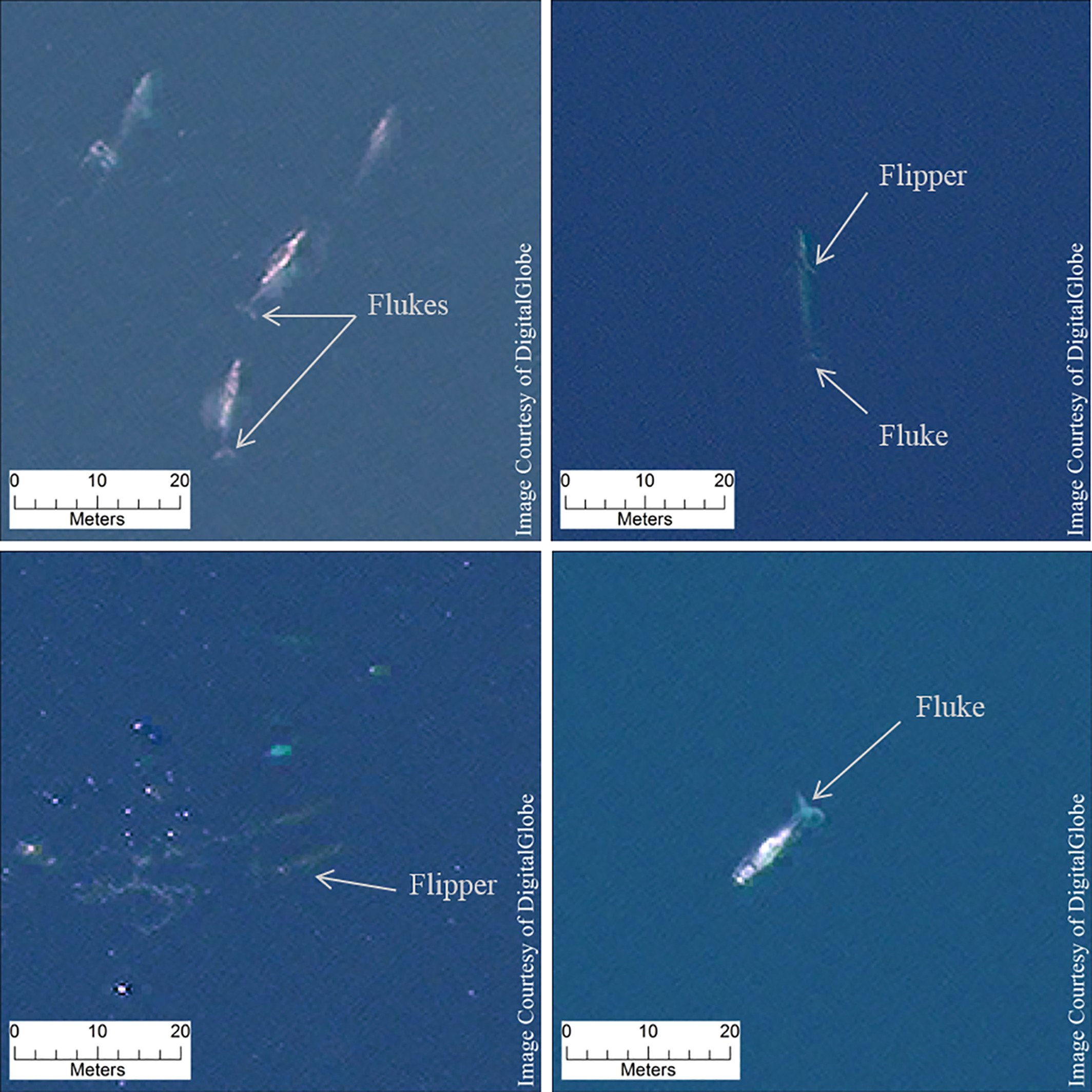
Previous studies found success in spotting whales from space, but the results weren’t very convincing because of the poorer resolution of older satellites. The new findings, which were published in Marine Mammal Science, relied on satellites launched by Digital Globe in 2014, which show an improved resolution of 12 inches.
Instead of scanning the entire ocean, researchers from the British Antarctic Survey and University of Cambridge chose four locations known to host a lot of whales, including gray, fin, humpback, and southern right whales. The locations include off the coasts of Hawaii, Mexico, Argentina and Italy, and the images they analyzed were caught when no other whale species were present in the hot spots.
The researchers scanned each image after blending color and black and white imagery. They conducted an additional automated analysis to find the reflectivity of individual images, since whales can be more reflective than the black ocean, although less than boats, planes and other objects which can be seen from space.
The images of the whales are quite detailed; they’re far from being little pixelated blobs, as the whales’ tails and flippers are visible. This enabled scientists to identify different species while tracking whales from space. Scientists were even able to see the white patches known to be present on southern right whales’ heads. The study could be a major contribution to conservation organizations which help protect endangered species like the blue whale, according to University of Minnesota ecologist Michelle LaRue, who has used satellites to track seals and reviewed the whale study.
“This is really cool to expand capabilities with the imagery,” LaRue told Earther. “I think whales in particular pose an extra level of complexity due to the need for calm sea state and their being at the surface, but my hope is this technology can add to other datasets from aerial and shipboard surveys.”
Unfortunately, the new satellites used to track whales from spaces have difficult time showing clear distinctions between whales and the ocean surrounding them so researchers could be stuck editing the images for now. The whale-spotting algorithm could also be useful in the future, especially if the satellite imagery improves even more.